תיאור הפריט
Documentum item:
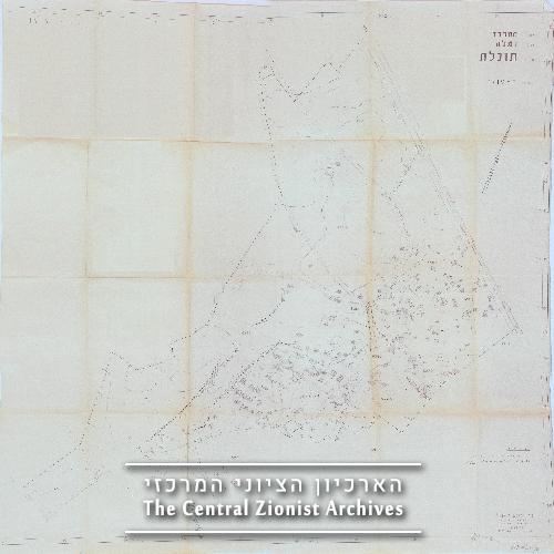
<CzaSearchDataReturnList><QueryString /><TotalCount>1</TotalCount><PropData><r_object_id>09001e15805eebee</r_object_id><r_object_type>cza_map</r_object_type><close_web_scan>false</close_web_scan><close_web_data>false</close_web_data><purch_block>false</purch_block><purch_free>false</purch_free><object_name>KL20M\276\8</object_name><r_content_size>9783872</r_content_size><description>תוחלת (ספריה). מפת תכנון ישוב. סימון תחום שטח הגושים והמגרשים וציון מספריהם. סימון בצבע מגרשים בודדים ללא מקרא מפרט. סימון מבנים: רפת, לולים, חנויות, מכבסה, ישיבה, בית ספר, בית כנסת, מסעדה, טיפת חלב, מרפאה, בנין מועצה אזורית. סימון מיקום פרדסים, בית קברות. סימון תוואי דרך סלולה. סימון תוואי מסילת הברזל. סימון תוואי תעלה</description><date_of_appearance>1958</date_of_appearance><original_number></original_number><unit_type1>מפה פרושה</unit_type1><date_of_last_update>0</date_of_last_update><district>מרכז</district><sub_district>רמלה</sub_district><surveyor></surveyor><planner>קרן קימת לישראל</planner><length>117</length><width>101</width><publisher>קרן קימת לישראל</publisher><map_type>תכנון ישוב</map_type><from_scale>1:1250</from_scale><access_restrictions></access_restrictions><language></language><comments>העתק שמש</comments></PropData></CzaSearchDataReturnList> תוחלת (ספריה). מפת תכנון ישוב. סימון תחום שטח הגושים והמגרשים וציון מספריהם. סימון בצבע מגרשים בודדים ללא מקרא מפרט. סימון מבנים: רפת, לולים, חנויות, מכבסה, ישיבה, בית ספר, בית כנסת, מסעדה, טיפת חלב, מרפאה, בנין מועצה אזורית. סימון מיקום פרדסים, בית קברות. סימון תוואי דרך סלולה. סימון תוואי מסילת הברזל. סימון תוואי תעלה